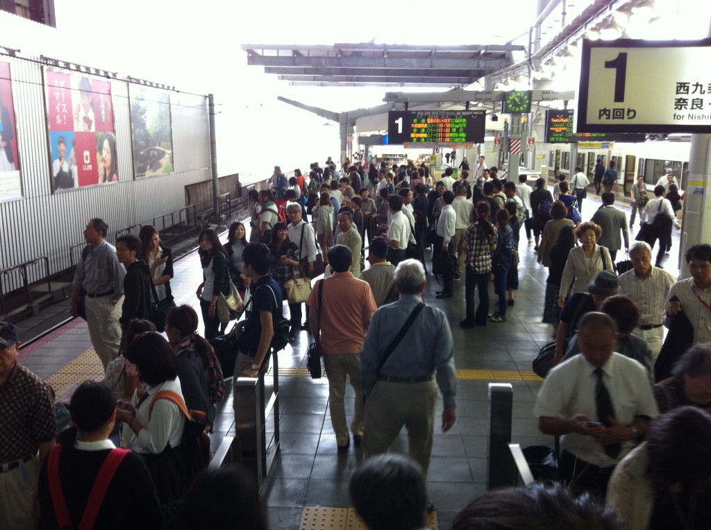
Osaka station
Em has the gift of a finely tuned internal compass. I do not, so she was a bit concerned about me navigating the streets of Japan without her. Also, my Uncle Roberto warned me that getting around by train is difficult because most of the signage is written in Japanese with very rare bits of English translations. As an aside, Japanese written language is ridiculously difficult for three reasons:
- It uses three completely different sets of characters which are interwoven.
- There are no spaces between words.
- The writing direction varies. In traditional Japanese, the writing is in columns read top to bottom and ordered right to left. In modern japanese, the writing is in rows read left to right and ordered top to bottom, just like in English. In practice though, most (maybe all) signage is in modern Japanese.
Conceptually, it reminds me of PHP, which is so loose with its rules and allows one to mix in HTML in such a way that it gets messy very quickly in practice.
Spoken Japanese is actually not bad since it doesn’t depend on tones like Chinese.
Anyhow, the premonitions from Emily and Uncle Roberto manifested themselves in me spending much of today on trains, some of which involved getting lost.
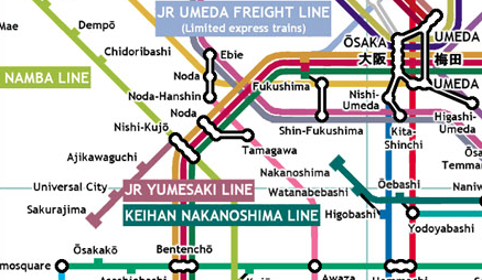
I present exhibit A: the unofficial but widely-cited map of the Greater Osaka Railway.
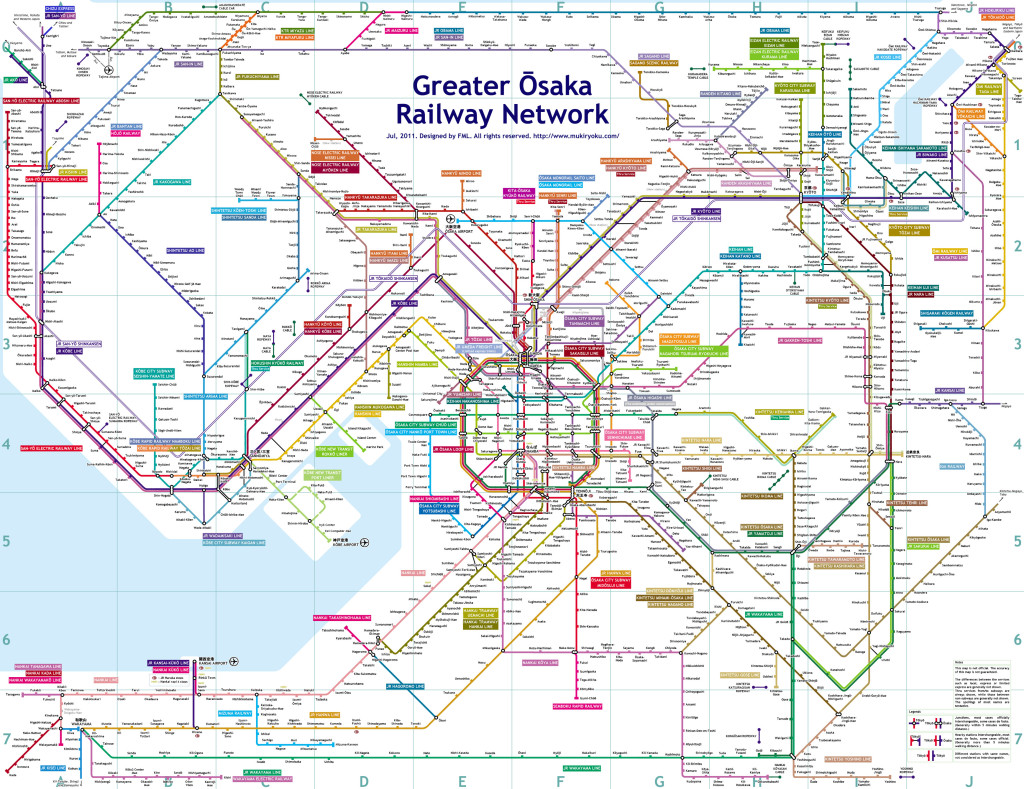
Greater Osaka Railway Network map by FML
It looks complicated and expansive, and it is. However, this map alone does not do justice to the complexity.
Said map is popular because it includes maps from all the overlapping networks (i.e. companies that run the trains) in the area (most official maps show only their individual networks). Anyhow, the networks I have ridden so far are the JR Network, the Hankyu Network, and the Nankai Network. The networks trip over each other and run parallel to each other sometimes. I can go between downtown Osaka and the area where our hotel is located via either the Hankyu Network or the JR Network. Each is just about the same price and takes about the same time. Sometimes a station will have a section for each network in it, and sometimes there will be a separate (but close) station for each network, each connected by a walkway. The various networks’ tickets are incompatible with each other.
Each network has lines that go to different areas – that part is pretty straightfowrard. The lines are identified by both a color and a name.
I’m not sure exactly what to call these, but within a single line on a single network, there are multiple things I’ll refer to as “schedules”. On transit systems I’m familiar with, sometimes there will be an “express” schedule that doesn’t stop at every single station but only hits the major ones. That’s the idea here, but instead of two, they have six or seven in Japan. The only place I have seen this information presented is inside the train cars.
-
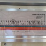
- Schedules for the JR Osaka Loop line
-
- Schedules for the Hankyu Takarazuka line
Note that on the Hankyu Takarazuka line above, there are two different schedules that are different in Japanese but translate to English as “express” and two others that translate as “semi-express”, so the English language cannot even capture the complexity of this rail system.
Hence we have three levels of hierarchy in this rail system: network, line, and schedule.
Here is a fun list of things that are screwed up about this system from an information architecture point of view:
- Maps at the scale that show the whole metropolitan area do not contain enough detail to show the schedules in the context of the entire system; seeing both requires either memorizing one level or flipping back and forth between maps.
- The colors have different and conflicting meanings depending on which level one is dealing with (line or schedule).
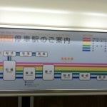
- While there are six or seven schedules shown on the maps inside the train cars, the platform signs only indicate a binary of “local” or “express”. A circle represents “local”, and a triangle represents “express”. The Japanese may contain more detail on the overhead signs, but that is clearly beyond me and exacerbated by the fact that there are no spaces between words.
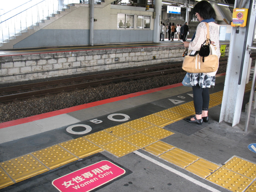
Platform indicators of a circle representing “local” and a triangle representing “express”. The number refers to the number of the car on the train. These points designate where the doors on the train will align. Also interesting is the women only car designation – a nice way to provide a safe space on the train.
If someone writes directions for you and tells you to take the “Hankyu Kyoto Line from Takatsuki to Suita”, you have to figure out that “Hankyu” is the name of the network, “Kyoto” is the name of the line, and you had better get on a schedule that stops at Suita (which the express schedules do not).
The first point at which I got lost was on the JR Osaka Loop line. Here’s a close-up. I boarded at Osaka, and I wanted to go through Bentencho near the bottom, but I ended up inadvertently going to Universal City. It looks as though you have to transfer at Nishi-Kujo in order to do that since the line that goes to Universal City is detached, right? Wrong! There is a train that goes from Osaka to Universal City, and it happened to be the one I got on. The map inside the train car with a detail of the JR Osaka Loop line depicted the route in the same misleading way. I haven’t quite figured out those detached sections – I’m not sure if all trains on the schedule in question go out to the stops on the detached section and then come back and continue down the main line or if only some trains go up the detached section but some skip it, which would suggest a fourth level of hierarchy.
I ended up inadvertently going to the Universal Studios station at this point, which was as annoying as it sounds.
Another thing I discovered was that any ticket one buys is only valid for starting at the station at which one bought it. I learned this lesson the hard way. Trying to save time, I bought two tickets at Station A: one for my departure to station B, and another for my return. When I tried to insert my second ticket at Station B, I got a generic error message on the turnstyle. It said something like “ticket not valid from this location”, and it wouldn’t let me through. I was very confused. Why would a ticket let me get from A to B but not from B to A? I had no concept of this! I asked the attendant at the ticket booth what was going on. I thought there was something wrong with my ticket. He didn’t speak English, but he circled the two stations on the map and kept saying the name of station A. I tried to explain to him that yes, that’s where I was trying to get to, and I showed him what was happening when I tried to insert my ticket, and I got the error. I only figured it out later when putting together this interaction with what was printed on the ticket.
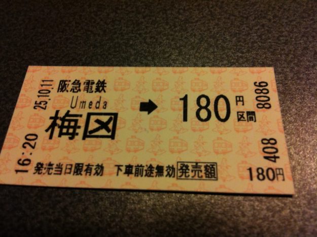
My ticket from Umeda station
The pricing on the trains is very granular. For the most part, each stop one goes ticks up the fare one notch. Given that (which is an interesting choice to begin with), it makes sense that the system needs to know how far each passenger has gone and prevent him/her from going farther than what he/she paid for. So the turnstyles require each passenger to insert a ticket when entering the station (the turnstyle punches a hole in it to indicate that it has been used once) and also insert the same ticket when leaving the station. What I question is the mechanism used to identify the start point. As designed, the mechanism is to encode the start point onto the ticket when it is first created at the ticket kiosk. The other (more liberating approach) would be to encode the start point on the ticket at the turnstyle – this way a ticket would be good for a ¥180 trip from anywhere to anywhere.
Also, I have always loved the simplicity of the MBTA, but now I have an enhanced appreciation for it.